cieldumort
Moderator

Reged:
Posts: 2473
Loc: Austin, Tx
|
|
6:00PM EDT 27 September 2024 Update
Helene has become a Post-Tropical Cyclone, having merged with the large mid-latitude and frontal low pressure system over the Ohio valley. Now hybrid Helene is still producing catastrophic flooding as well as severe thunderstorms and damaging wind gusts. The death toll and devastation keeps rising. Helene will almost certainly be a name that gets retired.
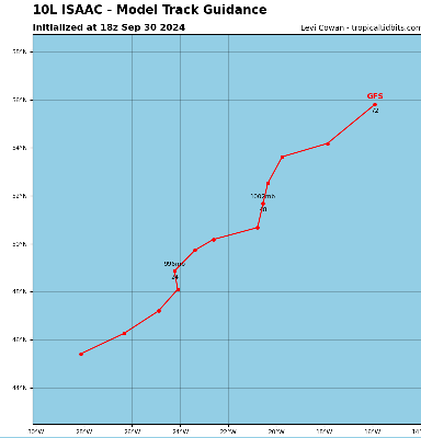
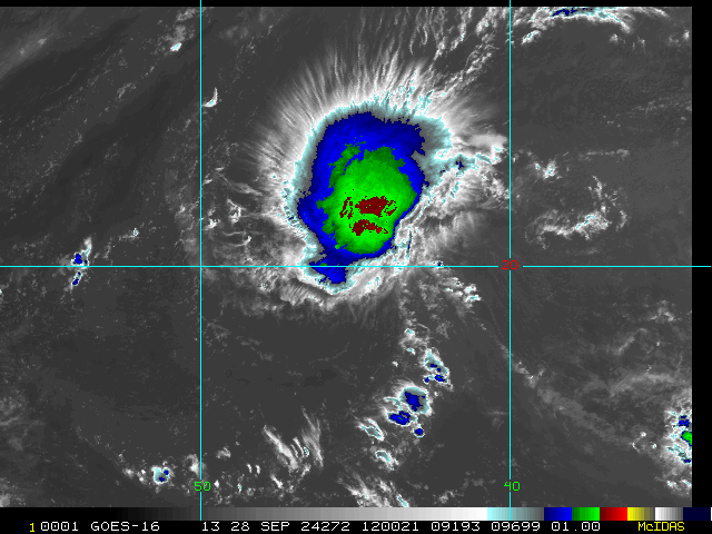
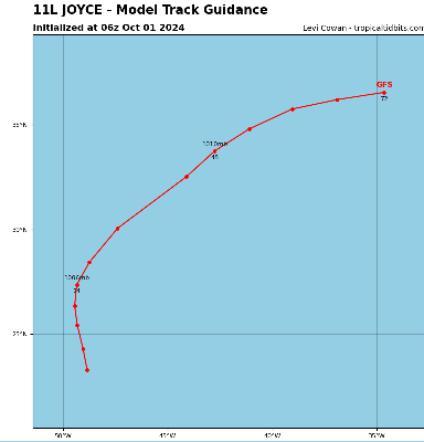
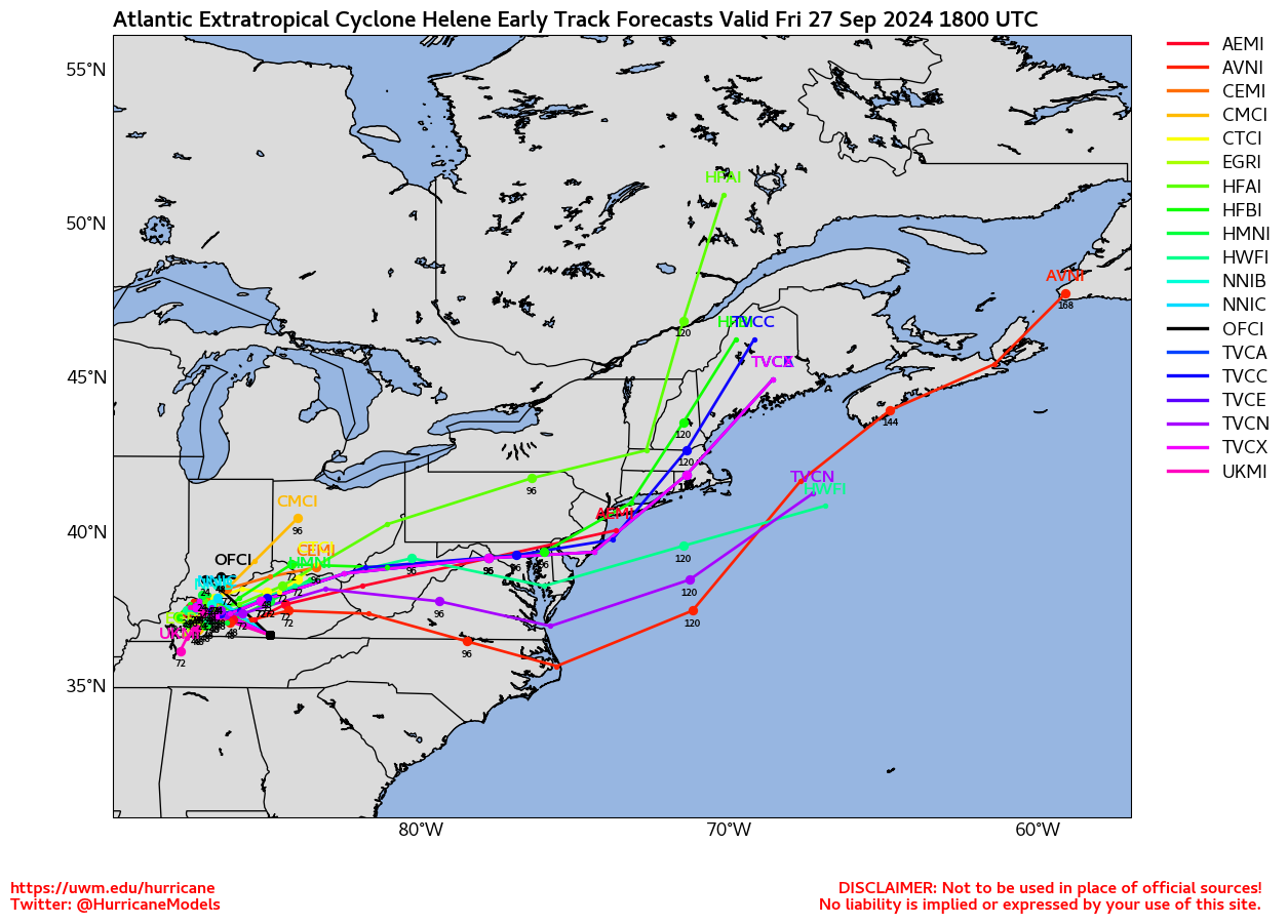
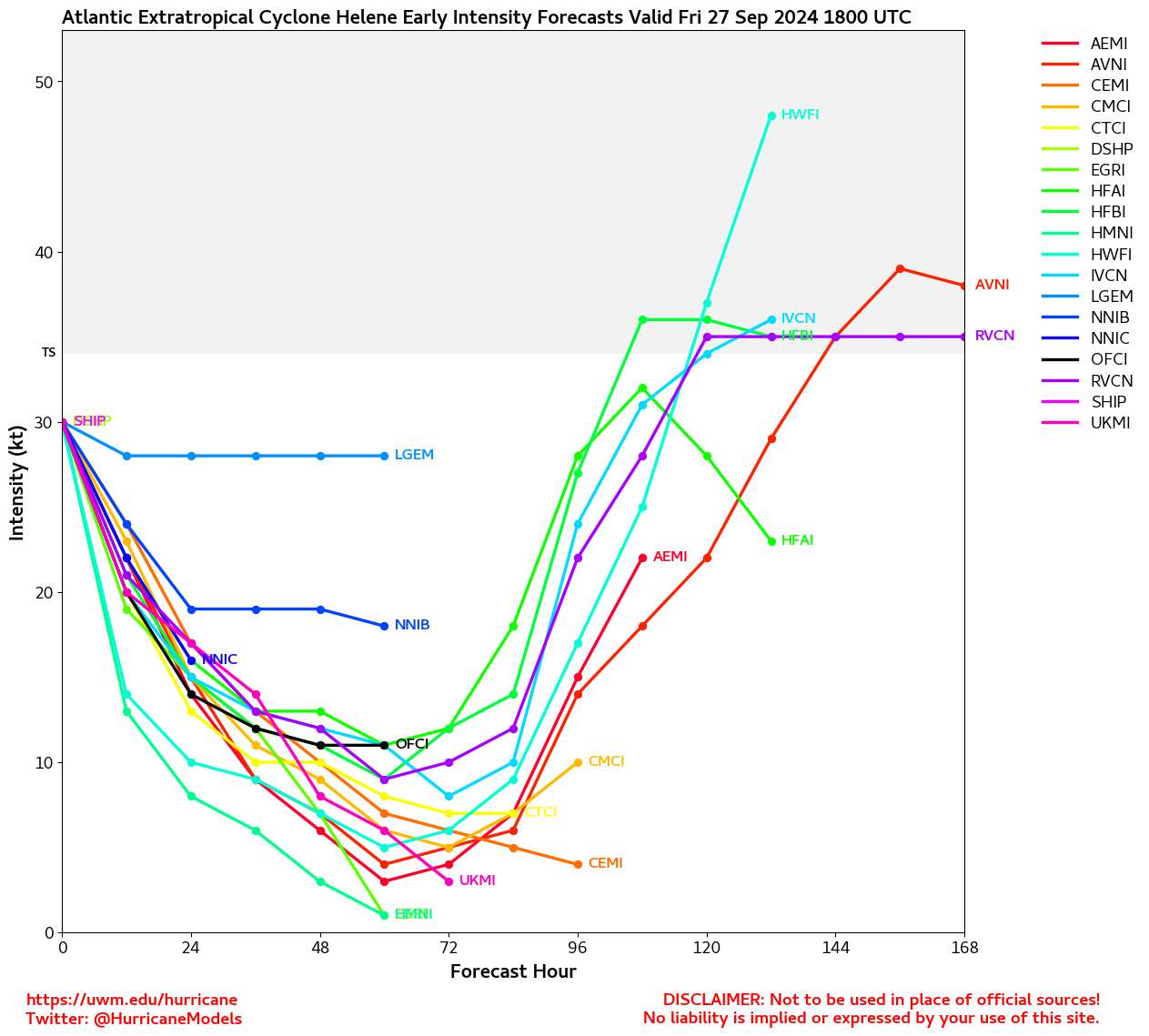
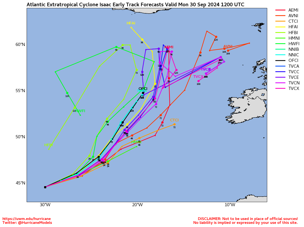
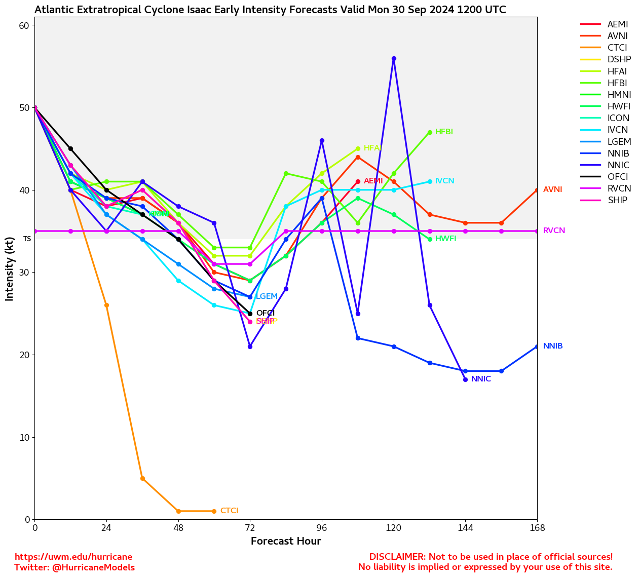
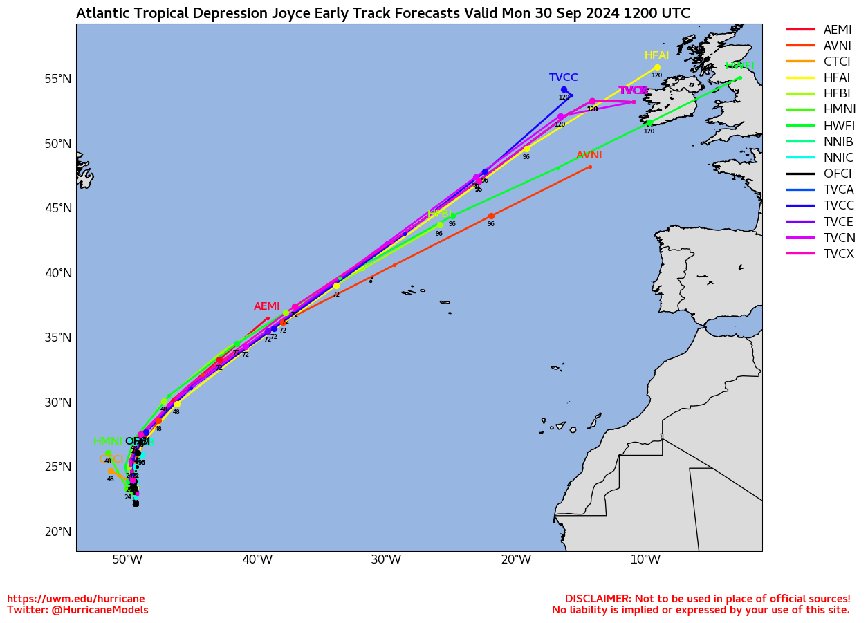
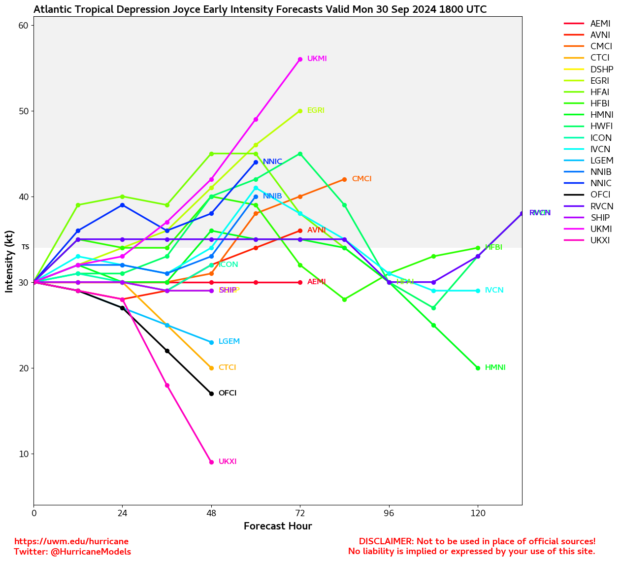
Elsewhere, Invest 98L has become Tropical Storm Joyce, and Isaac has become a strong hurricane. Both of these should stay out at sea, but may be a threat down the road for the Azores and/or western Europe.
Our nearby attention turns back to the Caribbean and Gulf, where development is becoming increasingly possible again next week.
8:00AM EDT 27 September 2024 Update
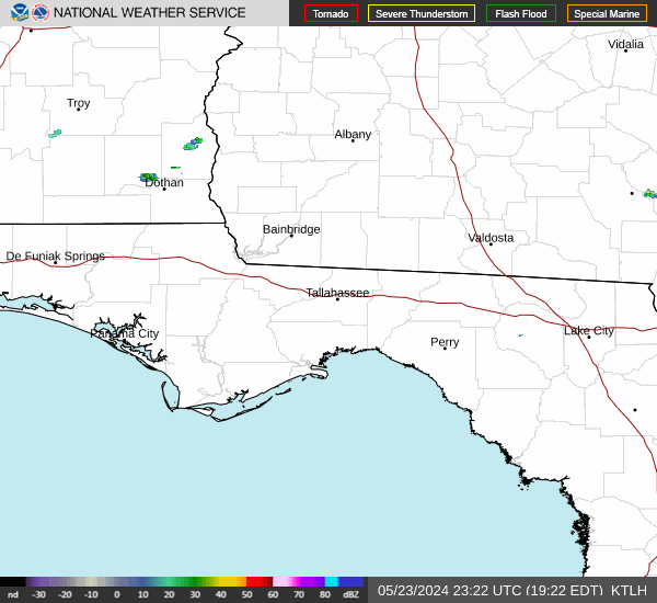
Hurricane Helene made landfall near Perry Florida last night, and now is moving inland and currently east of Atlanta, it will rapidly weaken but bring flooding rains to much of the southern Appalachian regions. All Warnings for Florida have been dropped. Helene's primary story will likely be storm surge flooding in Florida, but north of Florida the rain and wind impacts will likely be the focus.
Beyond Helene another area in the west Caribbean needs to be watched in the Gulf likely next week, but this one is more likely to affect areas west of Florida including Mexico. It has a 30% chance to develop over the next 7 day. Isaac is still churning in the open Atlantic and the other two areas, 98L, is likely to develop there as well (90%), but should remain out to sea. The last area in the East Atlantic only has a 20% chance to develop.
11:20PM EDT 26 September 2024 Update
Helene has made landfall as an exceptionally large and strong Cat 4 Major in the Florida Big Bend region at 11:10 PM EDT, 10 miles (15 km) west-southwest of Perry, Florida.
6:00PM EDT 26 September 2024 Update
Recon is just now getting back into the eye of Major Hurricane Helene and we will soon have another look under the hood. Last few passes showed a high-end Cat 3 intensifying at a quicker pace.
In the wise words of Stu Ostro,
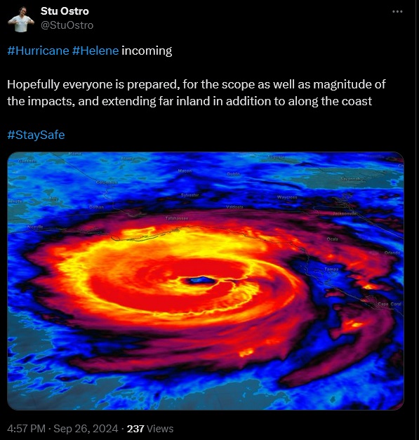
2:30PM EDT 26 September 2024 Update
Recon has found Helene has strengthened into a Major Hurricane (Saffir-Simpson Category 3 and above), with maximum sustained winds of 120 MPH.
10:00AM EDT 26 September 2024 Update
Helene is now a very large and dangerous Cat 2 hurricane. The radius of maximum sustained winds is very large, and surge is likely to be monstrous with this one.
There are some indications that Helene may be bending a bit right of the center line, which would have some implications for who gets the worst. However, given the exceptional size of this hurricane, not getting the worst is not the same as not having substantial impacts.
5:00PM EDT 25 September 2024 Update
The official forecast now calls for Helene to become an exceptionally large Category 4 Major heading into landfall. This forecast if verified will be catastrophic. Preparations to protect life and property should be rushed to completion today, and all in mandatory evacuation zones should have already left or be leaving now.
Quote:
CHANGES WITH THIS ADVISORY:
The Storm Surge Watch east of Mexico Beach to Indian Pass has been upgraded to a Storm Surge Warning.
The Tropical Storm Watch north of South Santee River to Little River Inlet has been upgraded to a Tropical Storm Warning.
SUMMARY OF WATCHES AND WARNINGS IN EFFECT:
A Storm Surge Warning is in effect for...
* Mexico Beach eastward and southward to Flamingo
* Tampa Bay
* Charlotte Harbor
A Hurricane Warning is in effect for...
* Anclote River to Mexico Beach
* Cabo Catoche to Tulum, Mexico including Cozumel
A Hurricane Watch is in effect for...
* Cuban province of Pinar del Rio
* Englewood to Anclote River, including Tampa Bay
A Tropical Storm Warning is in effect for...
* Florida Keys, including the Dry Tortugas
* Flamingo to Anclote River, including Tampa Bay
* West of Mexico Beach to the Okaloosa/Walton County Line
* Flamingo northward to Little River Inlet
* Lake Okeechobee
* Rio Lagartos to Cabo Catoche, Mexico
* Cuban provinces of Artemisa, Pinar del Rio, and the Isle of Youth
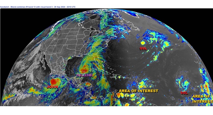
Elsewhere, former Major Hurricane John in the East Pac has redeveloped after moving inland, and back out in the Atlantic we are monitoring two features very close to being tropical cyclones already (both Invests: 98L and 99L), as well as even two more Areas of Interest we are monitoring. It is as if the peak of hurricane season was just delayed by two weeks this year and now is fully in action.
10:45PM EDT 24 September 2024 Update
Helene continues strengthening tonight and may already be knocking on the door of Category 1, hurricane.
There are some indications that Helene may not reach the Category 5 status prior to landfall that many earlier model runs advertised, and normally this would be a (qualified) "good thing." However, in the case of Helene, this would still come with the less-than-ideal result of the likely still-major hurricane becoming very large. In fact, Helene's radii are forecast to be in the top 90th percentile of Majors at this latitude. Consequently, this means storm surge and wind will be of an order of magnitude or orders of magnitude greater, and be experienced over areas even well outside of the center and location of landfall.
The cyclone is presently under very light shear and over exceptionally warm waters, and this environment is expected to continue more or less unabated up through landfall. Rapid Intensification is likely.
Those in the Warning zones should be hurrying preparations to protect life and property to completion at this time.
Ciel
5PM EDT 24 September 2024 Update
Helene has formed and is now expected to come ashore in the Big Bend as a very powerful and potentially large Major, with a risk of catastrophic damage even well inland.
SUMMARY OF WATCHES AND WARNINGS IN EFFECT:
A Storm Surge Warning is in effect for...
* Indian Pass southward to Flamingo
* Tampa Bay
* Charlotte Harbor
A Hurricane Warning is in effect for...
* Anclote River to Mexico Beach, Florida
* Cabo Catoche to Tulum, Mexico
A Hurricane Watch is in effect for...
* Cuban province of Pinar del Rio
* Englewood to Anclote River, including Tampa Bay
A Tropical Storm Warning is in effect for...
* Dry Tortugas
* Lower and Middle Florida Keys west of the Channel 5 Bridge
* Flamingo to Anclote River, including Tampa Bay
* Rio Lagartos to Tulum, Mexico
* Cuban provinces of Artemisa, Pinar del Rio, and the Isle of Youth
A Tropical Storm Watch is in effect for...
* Lake Okeechobee
* Palm Beach/Martin County Line northward to the Savannah River
10AM EDT 24 September 2024 Update
Multiple recon missions into NINE this morning are finding the system's structure improving, though still a bit elongated and with convection displaced to the east by ongoing shear. But, it is very nearly a full tropical cyclone now and for all practical intents and purposes could already be named. It's a subjective call at this point and no one should be discounting it for lack of a name. "Helene" likely gets applied at any time now. The cyclone is on track to more likely than not become a Major Hurricane, and potentially a high-end one.
Ciel
7AM EDT 24 September 2024 Update
Hurricane Watches are up for about half of the Gulf Coast of Florida from Englewood northward and westward to Indian Pass, including Tampa Bay. TS Watch West of Indian Pass Tropical Storm Watches are up to the Bay/Walton line, TS Watch south of Englewood to Bonita Beach. Inland Tropical Storm watches exist for much of the rest of Central Florida.
It's still currently called Potential Tropical Cyclone NINE, and might not get the name (Helene) until tonight. After, NINE will likely rapidly strengthen tomorrow and Thursday right up until landfall, which the forecast is probably somewhere close to Steinhatchee in the Big Bend as a 115mph hurricane (Cat 3). It's possible the system could strengthen more than anticipated. Surge is likely around the West coast and much of that is also under a watch, with 5-8 ft currently forecast for parts of the Tampa area, and up to 15 ft along the Big Bend (The worst surge will likely be at the point and just right of landfall). The next full track updates come around 11AM, then 5PM. (And that cycle keeps going).
The system will be moving very quickly and also likely impact folks well inland in Georgia
8AM EDT 23 September 2024 Update
Watches and Warnings are likely to begin as soon as later this morning for the system we are watching in the NW Caribbean (97L), and may explicitly call for a strong if not major hurricane within the 5 day cone.
Ciel
3PM EDT 22 September 2024 Update
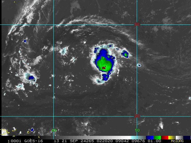
The Gyre we have been watching over Central America has spun out a developing disturbance in the northwestern Caribbean, which has now been Invest-tagged, 97L.
Vort-centric model runs, "hurricane models," are now being initiated on our newly-tagged Invest. In addition, a load of recon flights have also been scheduled.
Watches and Warnings could be coming as soon as tonight or Monday.
Original Update
Base map credit: Zoom.earth
The unexpected season of far fewer names than forecast, but with far higher a percentage of actual landfalls, looks set to continue in the coming days, with the potential if not likelihood of a strong tropical cyclone US impact.
A Central American Gyre, something that frequently forms in the early and latter parts of the Atlantic Hurricane Season, has persistent, strong model support for spinning up a named storm in the northwestern Carib and/or the Gulf as soon as early next week, and interests from the NW Carib into the all of the Gulf, but possibly most of all central to eastern Gulf, may want to begin paying much closer attention, as watches and warnings could be going up any day now.
We already have a Forecast Lounge up for this system where we are delving deeper: Helene Forecast Lounge
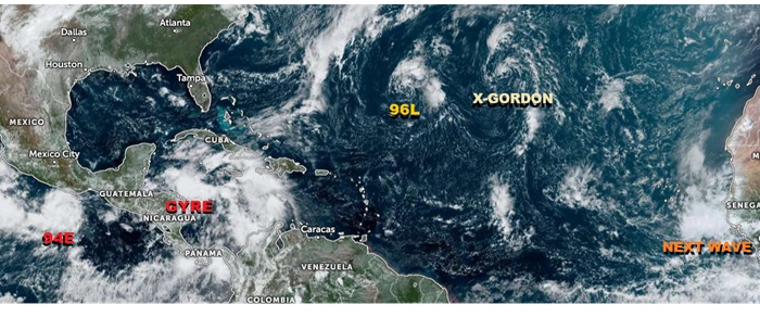
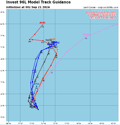
Elsewhere, Invest 94E in the East Pac may become a player in the evolution of our NW Carib/Gulf system, as it is set to track northeast and possibly get entrained, or even cross over land to the Atlantic side and maintain itself in some fashion. Farther out in the Atlantic, Invest 96L had been a borderline tropical cyclone for over a day and may be a candidate for post-season reanalysis. Former Tropical Storm Gordon is also still out there. Both of those are spinning fish. Long-range, a new wave rolling off western Africa has a chance to become a long track CV type system with plenty of time to track.
Edited by cieldumort (Fri Sep 27 2024 06:18 PM)
|
cieldumort
Moderator
Reged:
Posts: 2473
Loc: Austin, Tx
|
|
2. SUCCEEDING DAY OUTLOOK:
A. CONTINUE 6-HRLY FIXES IF SYSTEM DEVELOPS.
B. MORE NOAA P-3 TAIL DOPPLER RADAR MISSIONS INTO THE SUSPECT AREA FOR 25/0000Z AND 25/1200Z, DEPARTING KLAL AT 24/2000Z AND 25/0800Z RESPECTIVELY.
C. MORE NOAA G-IV SYNOPTIC SURVEILLANCE MISSIONS AROUND SUSPECT AREA FOR 25/0000Z AND 25/1200Z, DEPARTING KLAL AT 24/1730Z AND 25/0530Z RESPECTIVELY.
II. PACIFIC REQUIREMENTS
1. NEGATIVE RECONNAISSANCE REQUIREMENTS.
2. SUCCEEDING DAY OUTLOOK: POSSIBLE MISSION INTO SUSPECT AREA EP94 NEAR 15.8N 98.0W FOR 24/1730Z.
|
|


 Threaded


