1:15PM EDT 4 October 2024 Update
Recovery operations continue from Major Hurricane Helene, which is now the deadliest -landfalling tropical cyclone since . The tragic loss of life from Helene is mostly due to the all-too-often underappreciated inland flooding, and maybe finally a move to a more comprehensive TC Impacts Scale rather than merely a wind scale (Saffir Simpson) will start.
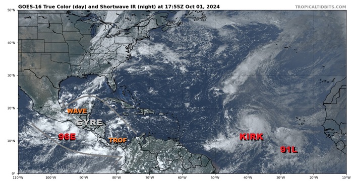
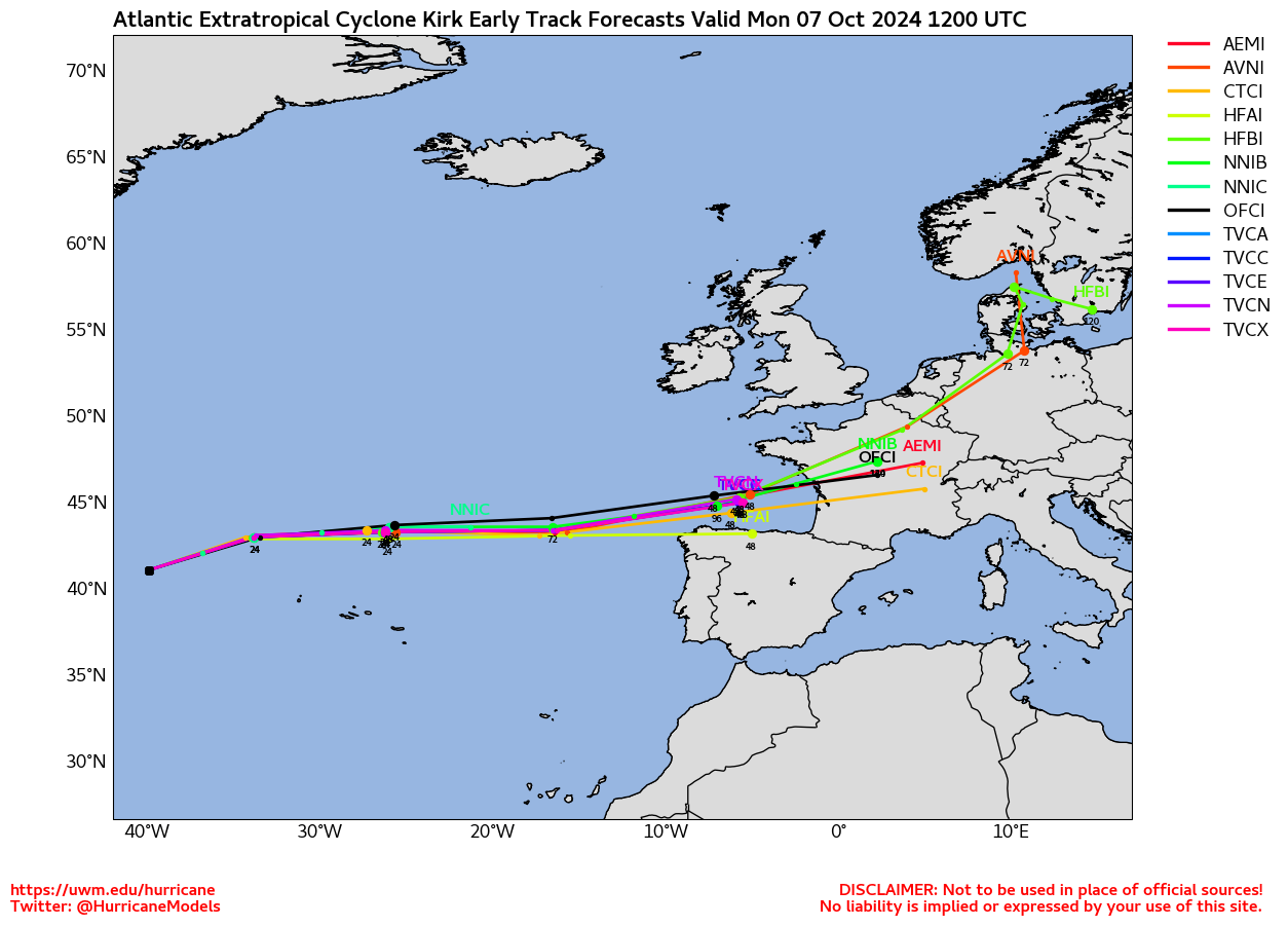
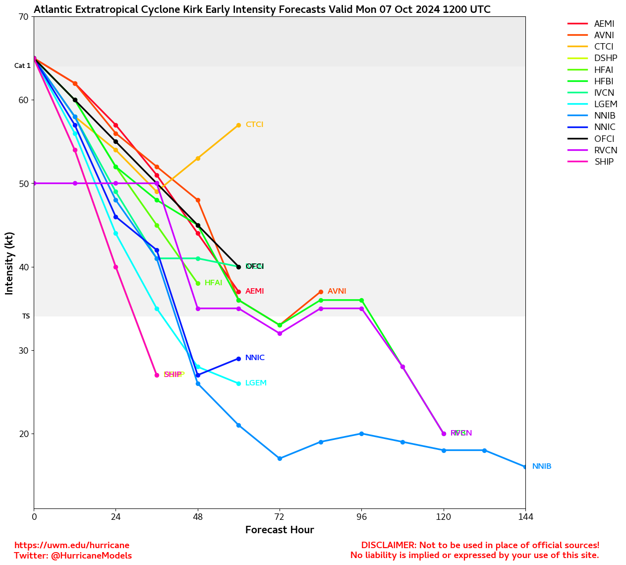
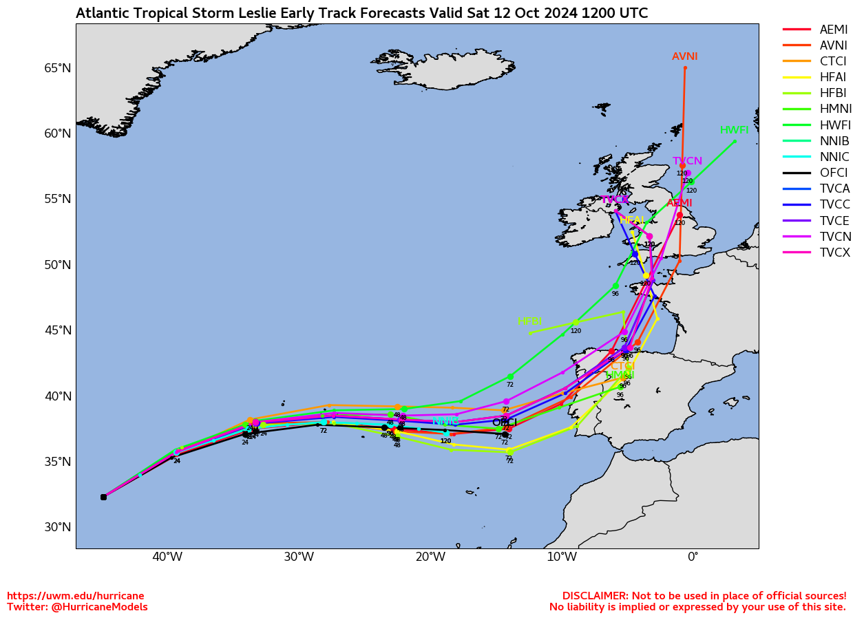
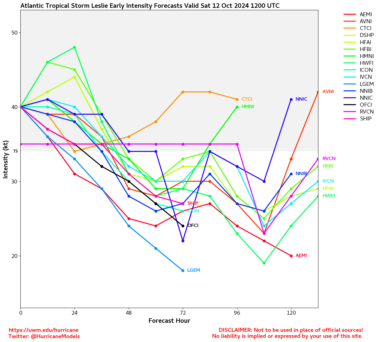
Unfortunately, this season is not yet over, with climatologically about a quarter of the activity remaining, and there is a risk that this year could even continue to be back-loaded if not also go into overtime, and we are now watching two named TCs (record-setting Major Hurricane Kirk, and Leslie, which is likely to become a strong hurricane as well), plus three additional Areas of Interest.
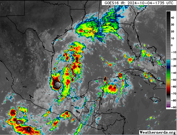
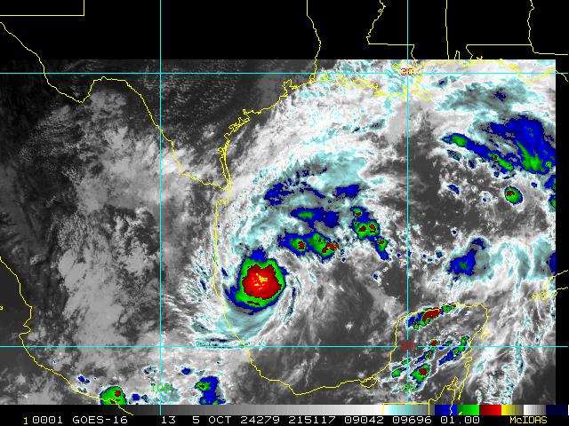
Closest to home is the feature we have been watching that is now in the western Gulf of Mexico and has increasing model support for significant development. While this system does not yet have an Invest tag, one could be assigned later today or sometime this weekend, and interests from eastern Mexico to the northern Gulf coast states and Florida may want to begin paying closer attention.
We do have a Forecast Lounge up on the Gulf Area of Interest: 92L Lounge
Original Update
After being in hibernation during the climo peak of the season, the Atlantic basin turned on a dime last month with the arrival of a very favorable pulse, and the generally supportive to very supportive conditions for TC development persist as we start the month of October.
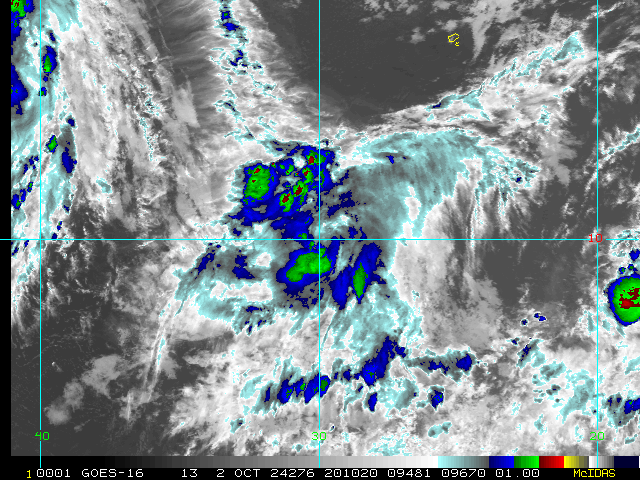
Most recently and closest to home, a gyre is apparent over Central America, helping lift up and enhance a wave that has just tracked into the Bay of Campeche on the Atlantic side of the Isthmus of Tehuantepec, a preexisting trof that has come off northwestern South America, and also an area of low pressure (Invest 96E) on the Pacific side of the Isthmus of Tehuantepec. All three of these disturbances are likely to influence development, if any, in the Western Atlantic (Gulf and Caribbean) over the next few days. There is also some potential for 96E to cross over into the Gulf.
Way out in the eastern Tropical Atlantic, recently-named Kirk is now a hurricane and forecast to become an ACE building Major far away from North America, and also a stout low behind Kirk, Invest 91L, is likely to become a TC any day now. 91L's future track is less certain and will be watched.
Edited by MikeC (Fri Oct 04 2024 09:27 PM)


 Threaded


